
Drone-based LiDAR
Drone-based LiDAR (Light Detection and Ranging) is a remote sensing technology that uses laser pulses to create high-resolution 3D maps of terrain, buildings, vegetation, and other objects. Mounted on drones (UAVs), LiDAR systems provide precise elevation and surface data, even in areas with dense vegetation where traditional photogrammetry struggles.
Drone-based LiDAR systems integrate multiple advanced technologies to achieve high-precision 3D mapping. Below is a breakdown of the essential components and design aspects of a drone-based LiDAR system.
Key Components of Drone-Based LiDAR Systems
LiDAR Sensor – Emits laser pulses and measures the time it takes for them to return.
IMU (Inertial Measurement Unit) – Tracks the drone’s movement and orientation.
GNSS (Global Navigation Satellite System) – Provides geospatial positioning for accurate mapping.
Drone (UAV Platform) – Carries the LiDAR sensor and navigates the area.
Processing Software – Converts raw LiDAR data into 3D point clouds and maps.
When considering a LiDAR drone system, it’s essential to assess factors such as range, accuracy, payload capacity, and compatibility with specific applications to select the most suitable solution.
Key Components of Drone-Based LiDAR
A. LiDAR Sensor
Laser Source: Emits laser pulses (usually in the near-infrared spectrum, 900–1550 nm).
Scanner & Optics: Directs laser pulses toward the ground and collects return signals.
Receiver & Detector: Measures the time of flight (ToF) of each pulse to determine distance.
Point Cloud Generation: Combines multiple return pulses to create a dense 3D dataset.
Types of LiDAR Sensors Used in Drones
Rotating LiDAR – Uses spinning mirrors to cover a large area (e.g., Velodyne LiDAR).
Solid-State LiDAR – Uses MEMS or optical phased arrays (smaller and lightweight).
Single-Return vs. Multi-Return – Multi-return LiDAR is preferred for mapping through vegetation.
B. Inertial Measurement Unit (IMU)
Comprises accelerometers and gyroscopes.
Tracks the orientation (pitch, roll, yaw) and motion of the drone.
Essential for maintaining high-accuracy geospatial data.
C. Global Navigation Satellite System (GNSS)
Provides precise geolocation data (latitude, longitude, and altitude).
Often uses RTK (Real-Time Kinematic) or PPK (Post-Processed Kinematic) correction for sub-centimeter accuracy.
D. Drone (UAV Platform)
Multirotor (e.g., quadcopters, hexacopters): Offers stability and maneuverability, ideal for small areas.
Fixed-wing drones: Cover larger areas with longer flight times.
Hybrid VTOL (Vertical Take-Off and Landing): Combines the benefits of both multirotor and fixed-wing designs.
Design Considerations:
Payload Capacity: Must support the weight of the LiDAR sensor, IMU, and GNSS.
Battery Life: Flight time ranges from 15 to 90 minutes, depending on drone type.
Stability: GPS-assisted flight ensures accurate LiDAR data capture.
E. Data Processing Software
Point Cloud Processing – Converts raw LiDAR returns into georeferenced 3D point clouds.
Classification & Filtering – Removes noise, classifies ground/non-ground points.
DEM/DTM/DSM Generation – Creates Digital Elevation Models (DEM), Digital Terrain Models (DTM), and Digital Surface Models (DSM).
Common Software Tools:
LAStools – Efficient LiDAR processing and classification.
TerraScan – Advanced point cloud processing.
Pix4D Mapper / LiDAR – Converts raw LiDAR data into accurate 3D models.
CloudCompare – Open-source LiDAR point cloud visualization and analysis.
- Design Considerations for Drone LiDAR Systems
A. Accuracy Factors
Flight Altitude: Lower altitudes yield higher resolution data but reduce coverage.
Point Density: Measured in points per square meter (ppm²); higher density improves detail.
Overlap: 50–70% overlap ensures complete coverage without gaps.
B. LiDAR Pulse Rate & Beam Divergence
Pulse Rate: 100,000 – 2,000,000 pulses per second (pps), depending on the sensor.
Beam Divergence: Determines footprint size; narrower beams improve resolution.
C. Environmental Considerations
Weather Sensitivity: Rain, fog, and wind can affect data quality.
Reflectivity of Targets: Highly reflective surfaces (e.g., water, metal) may cause data loss.
- Workflow of Drone LiDAR Operations
Mission Planning – Define flight path, altitude, and coverage area.
Data Collection – LiDAR drone captures point cloud data in real time.
Post-Processing – Apply corrections (IMU, GNSS, RTK/PPK), noise filtering, and classification.
Analysis & Output – Generate elevation models, contour maps, and 3D representations.
Vendors:
Draganfly
Offers the Long Range LiDAR system with a range of up to 750 meters and a point cloud precision of 0.5 cm, suitable for high-resolution data collection.
DraganFly
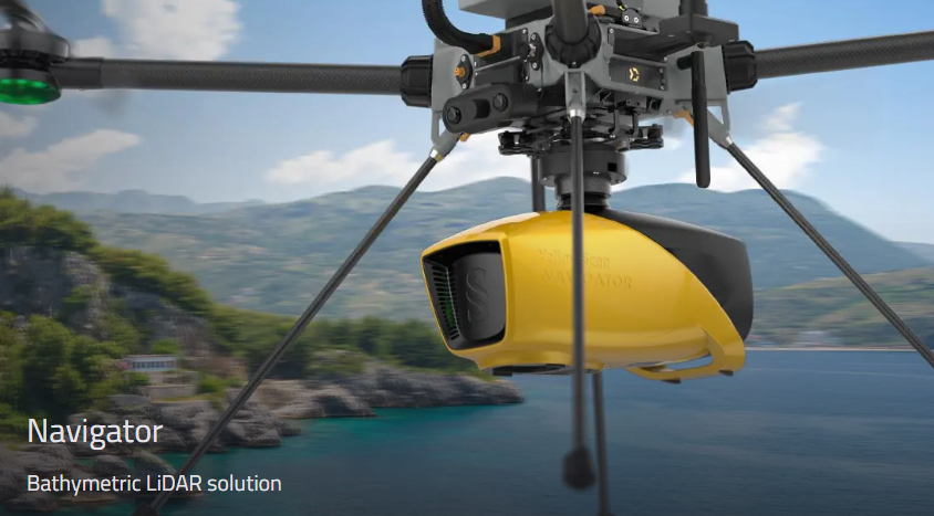
YellowScan
Provides integrated LiDAR solutions like the Explorer, designed for various UAV platforms, delivering high-accuracy scanning at altitudes up to 300 meters and ranges up to 600 meters.
yellowscan.com
GeoCue
Specializes in drone mapping solutions with products like the TrueView series, combining LiDAR and imagery sensors for detailed 3D mapping.
geocue.com
LIDAR USA
Offers versatile LiDAR systems such as the Surveyor 32, adaptable for UAVs, vehicles, and backpacks, emphasizing ease of use and high accuracy.
lidarusa.com
Routescene
Provides UAV LiDAR systems with features like hinged, foldaway GNSS antennas and quick-release connectors, enhancing field deployment efficiency.
routescene.com
When considering a LiDAR drone system, it’s essential to assess factors such as range, accuracy, payload capacity, and compatibility with specific applications to select the most suitable solution.